Flooding is an increasingly pressing issue across the United States, and Missouri is no exception. As we continue to witness the effects of climate change, many residents find themselves concerned about their flood risk and curious about their property’s vulnerability. Recognizing whether you are in a flood zone is paramount, as it influences not only your peace of mind but also property values, insurance premiums, and overall community resilience. In a state like Missouri, where landscapes vary significantly from urban centers like Kansas City and St. Louis to rural and river-adjacent areas, the necessity for understanding topography and flood history is clear.
Missouri’s geographical diversity and extensive river systems make it particularly susceptible to flooding events. According to research from the Missouri Department of Natural Resources, many areas are prone to flash floods, especially those near the Mississippi and Missouri Rivers. With nearly 13% of the state’s land area classified under floodplains, understanding flood zones is crucial for residents and stakeholders. Flood risks in these zones arise from both fluvial flooding, which occurs when rivers overflow their banks, and pluvial flooding, caused by heavy rainfall overwhelming drainage systems. This knowledge empowers residents to make informed decisions regarding flood insurance, home improvement, and emergency preparedness.
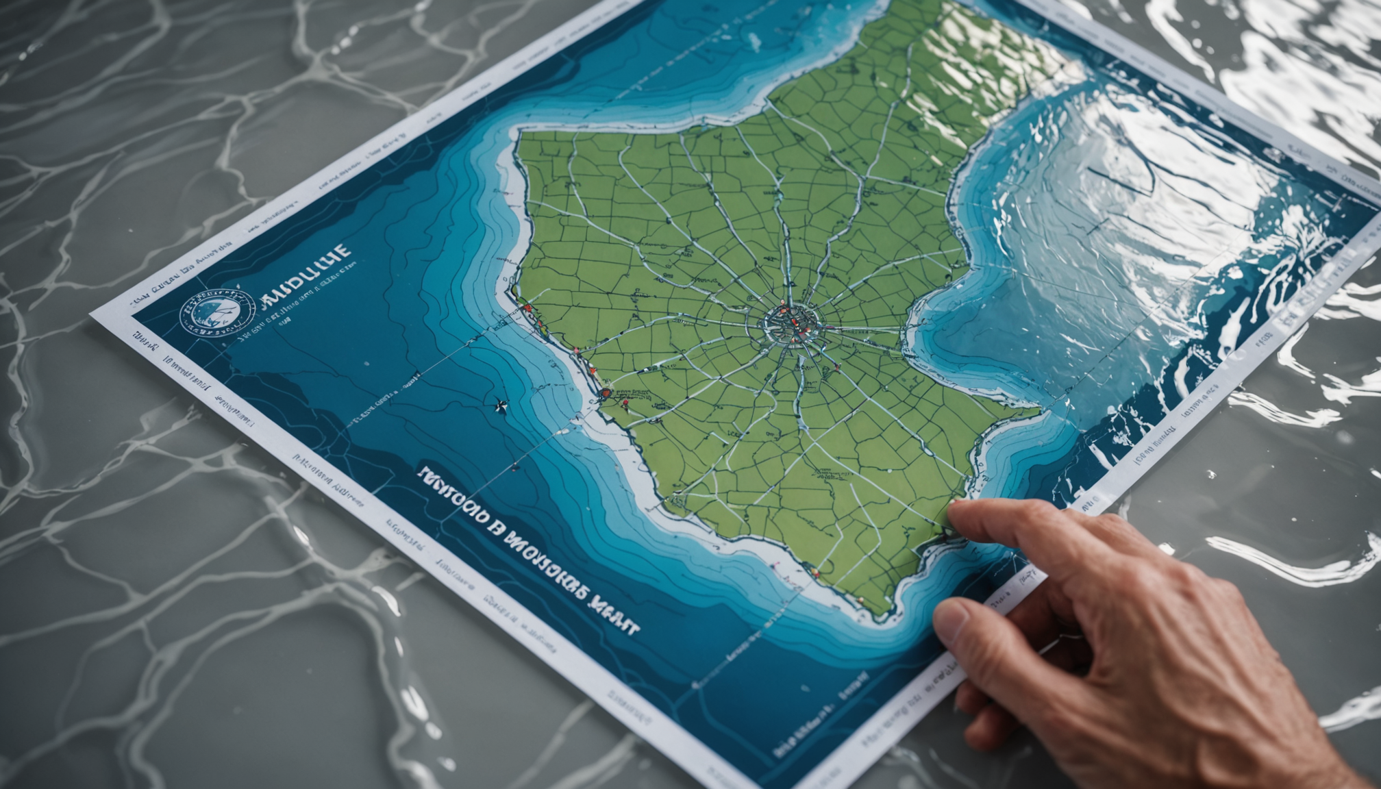
At the core of identifying these risks are FEMA maps—official tools that illustrate flood hazards on a large scale. These maps serve as the baseline for establishing flood risk, often informing zoning laws, building codes, and insurance requirements. However, understanding the dynamics at play in Missouri requires more than just map interpretation; it demands a keen insight into meteorological patterns, historical flood data, and developments in hydrological research. Residents need access to this layered information to accurately determine their flood risk beyond what is represented on traditional FEMA maps, ensuring they are adequately protected and prepared for potential flooding events.
FEMA’s tools for flood zone identification
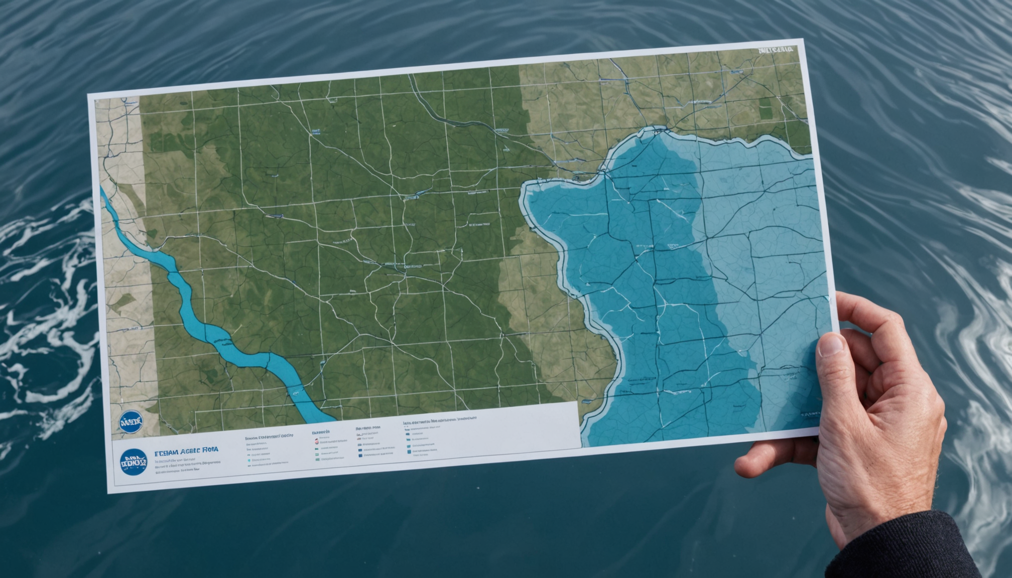
FEMA plays a pivotal role in providing tools and resources for flood zone identification across Missouri and the United States. At the forefront are the FEMA Flood Insurance Rate Maps (FIRMs), which are crucial for assessing flood hazards. These maps are developed based on data obtained from extensive hydrologic and hydraulic analyses, taking into consideration the topography and historical flood data of the area.
For Missouri residents, FEMA’s maps are fundamental in understanding their flood risk. The maps highlight areas that are likely to experience flooding by classifying them into various risk zones, such as high-risk (Special Flood Hazard Areas) and moderate- to low-risk areas. By referencing these zones, individuals and local planners can better prepare for flood events and make informed decisions regarding land use and infrastructure development.
The online FEMA Map Service Center is a valuable tool where homeowners and stakeholders can access the latest flood maps and related products. The platform allows users to search for and view flood zone data specific to their property or region within Missouri. This tool is vital for those considering purchasing flood insurance or undertaking construction projects, as compliance with local zoning regulations related to flood zones is mandatory.
Furthermore, updates to FEMA’s maps occur periodically to reflect changes in the landscape and improvements in flood modeling, ensuring that Missouri residents have access to the most current data possible. These updates are informed by ongoing research and collaboration with state and local agencies to better understand shifts in flood risks due to factors such as urban development and climatic changes.
For residents of Missouri, using FEMA’s tools is an essential step in safeguarding themselves against potential flood damages. Familiarity with your flood zone designation can greatly influence flood insurance policies and aid in implementing protective measures for your home or business.
- FEMA Flood Insurance Rate Maps (FIRMs) categorize land into various flood risk zones, guiding insurance and building requirements.
- The FEMA Map Service Center provides an online platform to access updated flood zone data, vital for homeowners and developers.
- Regular updates to FEMA’s maps incorporate new research and data, reflecting changes in landscape and flood modeling.
- Understanding your flood zone designation helps you make informed decisions about flood insurance and property improvements.
- FEMA’s collaboration with state agencies enhances the accuracy of flood maps, ensuring residents have up-to-date flood risk information.
The First Street Foundation’s flood model
The First Street Foundation offers an innovative approach to flood modeling that complements the federal resources provided by FEMA. The organization has developed a sophisticated flood risk model that presents a more granular understanding of flood risks, particularly beneficial for states like Missouri. Unlike FEMA maps, which generally categorize areas based on broad flood zones, the First Street Foundation’s model delivers comprehensive property-level flood risk information. This is important for homeowners, insurance providers, and local planners who need detailed data to make informed decisions.
The First Street model utilizes a wide array of data inputs, from historical flood records to predictive climate models, creating an advanced simulation of potential flood events. This methodology takes into account not only existing topographical and meteorological data but also the projected effects of climate change, such as increased rainfall intensity and frequency. Such a holistic view is critical in Missouri, where urbanization and changing weather patterns can drastically alter flood dynamics over time.
One of the standout features of First Street’s flood model is its ability to generate future risk assessments. By simulating potential future scenarios, it helps property owners and developers in Missouri anticipate how flood risks might evolve. This forward-looking capability is particularly valuable in areas undergoing rapid development or those situated near the state’s extensive river systems, which include the Mississippi and Missouri Rivers. With this foresight, communities can better prepare and adapt their infrastructure to minimize future flood damage.
Moreover, the First Street Foundation equips users with access to its Flood Factor tool, a user-friendly online interface that allows individuals to check the flood risk for any specific address in Missouri. This personalized risk analysis is instrumental in helping residents understand their property’s specific vulnerability to flooding, beyond what general FEMA maps might indicate. Such detailed information can be pivotal for homeowners evaluating insurance premiums and potential property improvements or mitigation strategies.
The reliance on continuous research and technological advancements enables the First Street model to maintain its relevance and accuracy. As new data becomes available, the foundation updates its model to reflect the latest understanding of flood risks. This adaptability is crucial in ensuring that residents of Missouri have the most current and precise information necessary to protect their assets and safeguard their communities from future flood hazards.
Comparing FEMA and First Street data
When evaluating the effectiveness and usefulness of both FEMA and the First Street Foundation’s flood data, several points stand out. Both systems bring unique capabilities and perspectives to flood risk assessment, but they cater to slightly different needs. FEMA maps serve as the regulatory benchmark for flood risk, influencing everything from insurance rates to municipal zoning. Their broad categorization of risk zones provides a foundational understanding of flood hazards but can sometimes overlook the nuances of individual property risk, particularly in states with diverse geographies like Missouri.
Conversely, the First Street Foundation’s model excels in offering a more personalized perspective on flood risk by incorporating an extensive range of data sources, including future climate projections. For individuals seeking a micro-level analysis of specific properties—such as those interested in purchasing a home or making improvements based on potential flood exposure—this resource offers unparalleled detail. Its capability to model future scenarios helps Missouri residents anticipate long-term risks, guiding both current decision-making and future planning.
When comparing the two, it’s evident that FEMA’s established authority and periodic map updates provide a reliable baseline for flood regulation and insurance purposes. These updates integrate new research, ensuring that stakeholders have robust, government-sanctioned data to rely upon. However, the First Street Foundation’s innovative model adds substantial value by emphasizing property-specific data and potential future conditions that FEMA’s maps may not fully cover. This capability is crucial for individual homeowners and businesses in Missouri, where localized flood risks can vary significantly due to factors like proximity to rivers or level of urbanization.
As you assess your flood risk in Missouri, consider utilizing both FEMA’s resources and the insights offered by the First Street Foundation. By comparing data from both sources, you can gain a comprehensive understanding of your property’s risks, allowing you to make more informed decisions about flood insurance, property improvements, and emergency preparedness.
Embrace the opportunity to educate yourself on these pivotal resources, and take proactive steps in response to the information they provide. Whether it’s considering flood-proofing investments or adjusting your insurance coverage, this knowledge empowers you to protect your home, community, and future against the uncertainties of flood challenges.
Steps to assess your flood risk
- How can I find out if my property is in a flood zone in Missouri?
- You can use FEMA’s Flood Insurance Rate Maps (FIRMs) as well as the First Street Foundation’s Flood Factor tool to identify if your property is located within a flood zone. These resources provide detailed information on flood risk levels for specific areas in Missouri.
- Why is understanding my flood risk important?
- Understanding your flood risk is crucial for making informed decisions about purchasing flood insurance, implementing protective measures, and ensuring compliance with local building regulations. It also helps mitigate potential damage to your property from flooding events.
- What are the main differences between FEMA’s maps and the First Street Foundation’s flood model?
- FEMA’s maps are regulatory tools that categorize areas into broad risk zones for insurance and zoning purposes, while the First Street Foundation’s model provides detailed, property-specific risk assessments, including future climate scenarios. Together, they offer a comprehensive view of flood risk.
- How often are FEMA’s flood maps updated?
- FEMA’s flood maps are periodically updated as new research and data become available to reflect changes in landscape, urban development, and flood modeling. This ensures that residents have the most current information on flood risk in their area.
- Can I rely solely on FEMA maps for accurate flood risk information?
- While FEMA maps are a valuable baseline for understanding broad flood risk zones, they may not account for specific property-level risks or future climate projections. For a more detailed assessment, consider using additional tools like the First Street Foundation’s Flood Factor.